

Racing on the Iditarod Trail as part of the Iditarod Trail Invitational (ITI) is a magical, transformative adventure. It’s also hard to capture in images; particularly if you’re traveling solo and moving at night a lot - but there’s so much rich experience out there, it’d be a shame to not tell those stories. So below you’ll find a little mini series; an account for each day of the trail, trying to bring to life just WHY this winter race is so incredible. But before you dive into the play-by-play, take a look at this short clip.
——————————————
Day 1. Race Start to Butterfly Lake: 25.4 miles, 1300ft of ascent.
8 hours 59 minutes, 2840 calories burned. ~280 miles to go.
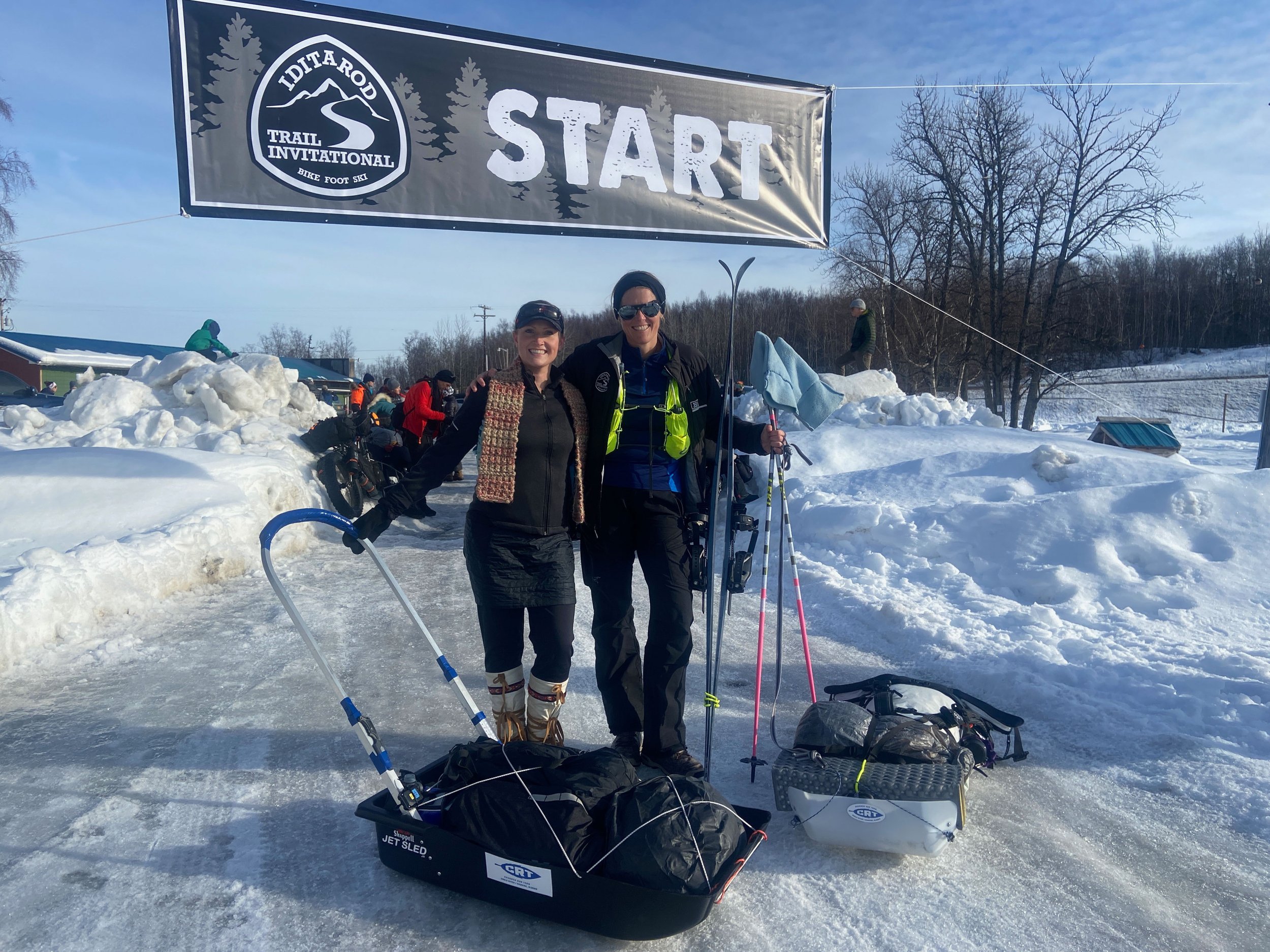
5k or 500km - race starts are frenzied. The ITI is no different: dozens of bikers, skiers and footraces are all going through final gear adjustments, getting ready to set out for 350 or 1000 miles on the Iditarod Trail. They say hello to old and new friends, and have last-minute course discussions: racers choose their own route from checkpoint to checkpoint, with a myriad of different options available near the start; some of them more waterlogged than others.
At 2pm the gun goes off, and everyone is on the move. After last year's experience, l am determined to not partner up with anyone for multi-day stretches - but it is wonderful to see Sarah and spend many miles in her proximity; both at the start, and throughout the race until the very finish in McGrath, more than 300 miles from here.
The distance to the first checkpoint is about a marathon. The weather has been warm and stormy. That means we expect overflow: standing water on top of the ice of solidly frozen over lakes and rivers. It means potentially getting your feet wet or even worse… falling in and getting submerged. Get wet, drop dead. Overflow is bad. Yet to my delight, the night prior to the start of the race brought cold temperatures and re-froze a lot of the overflow. We can get across our frozen lakes and rivers without the risk of getting soaked. In the early miles there are a few dog teams on Iditarod training runs, which means that we dive off the hardpacked trail to let them pass, then it's smooth sailing to checkpoint #1.

The sun sets shortly after 6pm; I reach Butterfly Lake just before 11pm, after hours of solitary night-time skiing. There's a warming cabin, hot soup and friendly volunteers around a big warm fire - heaven. Day 1 is done.
Day 2. Butterfly Lake to Yentna: 30.1 miles, 580ft of ascent.
12 hours 10 minutes, 3690 calories burned.
The first night, first checkpoint of the ITI is a bit of an odd one. You’ve only been going for half a day; the checkpoint seems decadently early and, because the field hasn’t yet a chance to really spread out, it tends to be a hubbub of activity. Last year I spent a lot of time at Butterfly because my feet were killing me. This year, there’s no foot pain; I merely grab some soup and a short nap in the warming cabin. By 1am I am on the move again, headed for Checkpoint #2: Yentna Roadhouse.
I have to cover 30 miles to get to Yentna, crossing the Susitna River along the way. I’m intimidated - the Su is notorious for overflow and open water - but I end up getting across the river during the coldest hours of the night, shortly before dawn, without ever seeing water. From here on out it’s easy skiing on the Yentna where I arrive around lunch time. In theory, it is much too early to call it a day, yet after close to zero sleep the prior night I have a plan: nap, eat, nap again, and keep resting at the Yentna Roadhouse to my heart’s content.
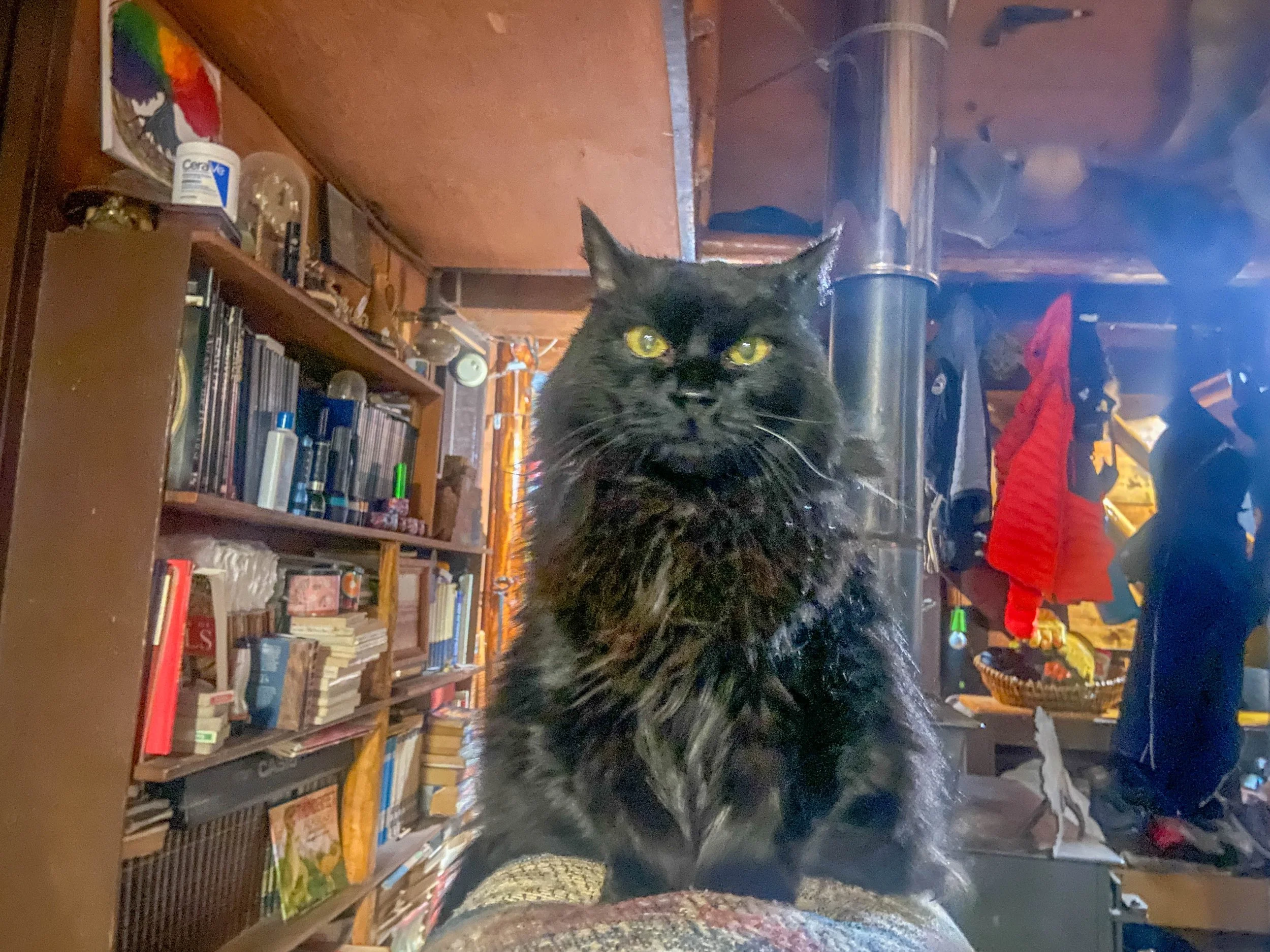
I like the vibe at Yentna - it’s a storied Iditarod trail stop, and to me it epitomizes the spirit of the Alaskan roadhouse: it doesn’t have one commercial iota in its rafters. If you want to sleep in the main house, you pay for a bed in one of the many upstairs rooms - the family’s children’s rooms. Rooms are always shared; sometimes beds are shared, too. Frequently you have to wait for a bed to free up before you get to claim your spot. There is no indoor plumbing, but there are lots of dogs, a cat, and always a warm fire.


I know things will get hard soon enough. I’m in no rush to leave Yentna, so I stay until well after dark.
Day 3. Yentna to Shell Lake: 46.2 miles, 925ft of ascent.
20 hours 50 minutes, 4270 calories burned.
I have no real race plan other than to move forward. And that’s what I do, leaving the warmth and comfort of Yentna Roadhouse at 10:45pm in the evening after an almost-ten-hour rest. While the prior night had gotten cold, down to the single digits, current temperatures are in the twenties — it's balmy. I strap on my skis, and promptly wipe out as I navigate back down to the river. Skiing with a sled is dangerous.
Once I’m safely back on the river, it’s just a matter of putting one foot in front of the other. Conditions are favorable; I am making good progress - right up until I round a turn and almost collide with a moose on the trail. OK, maybe that’s an exaggeration, but it sure felt too close for comfort. Alone in the night I am acutely aware of how small and weak I am. As I backtrack, the moose is coming towards me. It isn’t charging but it sure isn’t happy to see me either. I fumble with the clips of my sled, wanting to not be encumbered if the moose decides to charge. The hairs on my neck standing up, I turn around and start skiing vigorously back towards where I came from. The moose decides to stay put.

Even though the last thing I want to do is to chance another encounter, I know that my only path to safety is forward. This stretch along the Yentna River is notorious for moose, and I won’t feel better about where I am until the sun comes up or I reach the next checkpoint - whichever one comes first. So I gingerly put down new tracks on the far side of the river, skiing with bated breath across more moose tracks and fresh moose poop and a hint of open water.
I make it to Bentalit, 20 miles upriver, without further incidents just before the sun rises. The reward: a quick nap, and a surprise (and free!) hot shower. The miles after Bentalit are uneventful; more, smooth river interrupted by a bit of overflow and a few sunny miles in Sarah’s company. A quick stop at Skwentna, then a mellow afternoon ski to Shell Lake Lodge just in time for dinner. Day 3 is in the books.
Day 4. Shell Lake to the Happy Steps: 30.2 miles, 1550ft of ascent.
11 hours 35 minutes, 2300 calories burned.

With Sarah & Keith at Shell Lake Lodge
A good night’s sleep makes all the difference; and sleep I do at Shell Lake Lodge. I would have feasted on a burger, too, if the racer just ahead of me hadn’t cleaned out the kitchen with a double order. It’s all good — I did the same last year, at Yentna roadhouse, by ordering an 8-egg omelette. My breakfast was the last the roadhouse cooked that day.
From Shell, it’s a mostly flat 20-mile stretch to the next checkpoint at Finger Lake. I spend the day in the proximity of Sarah as well as Lars, another skier, but ultimately go at my own pace.
Thanks to a cell phone tower high up on a hill above Shell Lake we have signal, and I take advantage of just that by FaceTiming with Paul. In the afternoon the temperatures reach into the forties; I’m out in shirtsleeves, and eventually have to take my skis off because the snow is turning into cement glue.

Sticky snow — waxing didn’t help
I am taking good care to stop, rest and eat regularly. At the moment it all is feeling easy, almost too easy. Yes I’m tired from big miles every day.. but all within reason. The conditions are mellow, the pace manageable. I am enjoying myself. This year, the ITI actually feels like a vacation.
I reach Finger Lake before 4pm, and decide to rest and fuel up before the next big push. From here, we head up to Rainy Pass - straight into the Alaska Range. I spend three hours at the checkpoint and get moving again right as it is getting dark. The colder temperatures make for better skiing conditions, and I soon find myself on a cat track in prime conditions; I am flying along. I pass Lars sleeping by the side of the trail. It is snowing hard now. After I turn off the cat track towards the dreaded Happy Steps — a series of steep drops onto the confluence of the Happy and the Skwentna Rivers, the trail gets worse and worse. It is approaching midnight. I decide to stop and bivy. The snow is coming down; this is where I am grateful for the lightweight tent I brought along. I get set up, crawl in, and quickly fall asleep.
Day 5. Happy Steps to Rainy Pass: 17.9 miles, 2080ft of ascent.
8 hours 35 minutes, 1340 calories burned.
Here’s the thing about traveling with a tent: once you’ve got it set up you have little motivation to meter your rest. I end up sleeping for almost seven blissful hours. When I wake up the trail is buried under several inches of fresh snow. I pack up and get going.

Seven hours of sleep make for a fresh morning
The descent down the Happy Steps is mostly uneventful, even though none of it is skiable and I have my hands full wrestling my sled. In the beginning, I try to ride my sled only to realize that steep hills and fresh powder equals face shots. I cannot afford to get drenched, so I quickly abandon any additional attempts to sled.
I’m only 17 miles from the next checkpoint, but the terrain is more difficult now: hills, climbs, and more hills. I put my head down and slowly grind out the miles. Somehow, magically, the closer I get to Puntilla the friendlier the trail becomes. Fast, flat sections trade off with sleddable downhills that have me hollering with joy. I get more and more confident, sledding those steep narrow downs that would have been impossible on cross-country skis.
It’s all fun and games until I cockily sled down a steep drop that ends in a blind turn. As I zoom around the turn I discover that there’s no friendly runout here, but another steep drop followed by another blind turn. This calls for an emergency ejection. As I deliberately flip over my sled, my skis and poles jam squarely across the trail. I come to a hard stop on top of my gear. For a second, I hold my breath - did I break or tear anything, gear or tendons? My left knee is in an unnatural position, but seems unhurt. I gingerly get up; everything’s OK.
The bunk house at Puntilla
From here I cruise to Puntilla, the most luxurious of all checkpoints. Dinners at Puntilla are the stuff of legends. The lodge has an amazing bunk house which we racers get to sleep in. There are eight of us at Puntilla, and we make it a point to take full advantage of all there is to be enjoyed.
Day 6. Rainy Pass to Rohn: 33.3 miles, 2420ft of ascent.
13 hours 15 minutes, 2830 calories burned.
Puntilla felt like a celebration. It’s the halfway point of the ITI350, miles from the closest road; unless you are one of us long-distance winter ultra crazies, the only way to get up there is by dog sled, snow machine, or bush plane. It’s a tight community. That’s why I am sad to move on, even after an almost 18 hour layover.
Alas — the Alaska Range is calling and I must go. I leave Puntilla leisurely at 10am after a hearty breakfast. The crossing of the Alaska Range is a big day of more than 30 miles, yet I am confident that I will be able to travel efficiently. Except for a bit of wind the weather is good.
I am on fast, hard trail making smooth progress when I hear a crack. On my next pole plant I lose my balance because my right ski pole is suddenly eight inches shorter than expected. I curse under my breath; a broken ski pole halfway through the race is the last thing I need.
Frustrated, I navigate to the closest bush and try to splint the pole with branches, duct tape, and GearTies. No dice; the splint isn’t rigid enough. I tentatively continue skiing towards Rainy Pass, mulling over my options, when all a sudden there’s another crack — now my other pole has broken in the exact same spot. I realize that this can’t be a random event. Yesterday’s sledding crash pops into my mind; I had landed on my ski poles then. Oh well… at least my poles are even at this point. I manage to reposition the powder baskets onto the broken stumps; the only thing I’m missing at this point is 8 inches, and metal tips.

The rest of my long day to Rohn is uneventful, though I learn that skiing downhill with a sled on cambered trails isn’t fun. There are plenty of tumbles, followed by some open water, followed by hours of solitary skiing in the dark - including on glare ice, which makes me sorely miss my metal pole tips. And yet, despite the challenges, I arrive at the checkpoint after “only” thirteen hours on the move. The wall tent is stuffed full of sleeping racers, so I bed down outside below a tree.
Day 7. Rohn into the Farewell Burn: 42.0 miles, 2170ft of ascent.
17 hours 30 minutes, 4400 calories burned.
I made it across the Alaska Range! From here on out, every mile is new terrain for me: in last year’s COVID-edition of the ITI, the course turned around at Rohn and headed back east. This year, we are following the classic Iditarod Trail into the Alaskan Interior, across the Farewell Burn, towards the native village of Nikolai and on to the finish line in McGrath.
It’s almost eighty miles from Rohn to the next checkpoint in Nikolai, and I have heard conflicting reports about this stretch. It’s called the Burn because a massive, million and a half acre fire raged through here in 1978; according to some ITI veterans it’s nasty. Others say that this is the home stretch and not so bad. I’m about to find out that both statements are equally true.
Waders in ski bindings on the Kuskokwim
I depart from Rohn before daybreak, to get across the Kuskokwim River while it is frozen. The Kuskokwim is a big river crossing that has had other racers wading through thigh-deep overflow this year; as I cross in the early morning, it is frozen to the point where I don’t even have to get my feet wet.
Once on the other side of the river I quickly learn three things about the Burn:
There is a lot of ice.
Where there isn’t ice, there is a lot of dry tundra.
Where there isn’t ice or tundra, there are the world’s worst moguls.

Unfortunately none of those conditions are skiable. I end up carrying my skis for 42 full miles. Thank god for my LOWA Tibet boots which allow me to hike comfortably; I can't imagine doing this in stiff ski boots.
See the big dipper? So bright even the iPhone can see it.
Darkness catches me some 30 miles into my hike; I continue on. Eventually I catch up to the gaggle of racers ahead of me including Sarah, Keith and a few others. They’ve found a great bivy spot and made a bonfire. I join them by the fire for a few minutes but then keep going - it is too early for me to rest. I put down another eight miles in the dark before I decide to bivy in the trees right by the side of the trail. As I go to sleep tired and contentedly, the big dipper is perfectly overhead.
Day 8. Farewell Burn to Nikolai: 29.9 miles, 200ft of ascent.
11 hours 45 minutes, 2100 calories burned.
The Burn goes on forever. As I wake up from my bivy, I am dreaming about fewer moguls and more skiable terrain — but I am not holding out hope. Prepared for a slow grind to Nikolai I rise at daybreak and get on my way. All I have to do today is to cover the 30ish miles to the next checkpoint.
I’ve only been moving for half an hour or so when I hear a snow machine behind me. That can only mean one thing: Adrien. Adrien is one of the ITI’s core volunteers, and he has a knack for showing up with trail magic right where it’s needed the most. Last year, he Tyvek-taped my broken ski binding at Mile 200 while I was sleeping at his checkpoint. This year, he has made a habit of having a big bag of chocolates on the dash of his snow machine.
I pull off the trail to let Adrien pass, in exchange for two big handfuls of Reeses cups and some friendly banter. He assures me that the terrain will get easier towards Nikolai and that Sullivan Creek isn’t far from where we are. That’s great news: I am running low on water.
Once Adrien moves on, I do the same — just at a fraction of his speed. Even so the miles to pass quickly and I soon find myself skiing across the Sullivan Creek Bridge. I take a break to fill up with water. There are iodine pills in my pocket to treat the water, but my under-slept and over-cocky ITI brain decides I shouldn’t have to use them; it’s Alaska, after all! And, if I were to get sick from water-borne disease… it won’t hit me until way after the finish of the race anyway.**

From here to Nikolai the trail is mostly skiable, with the exception of a bit of open water right past the bridge, and a few more moguls. Either way: I’m having fun, with perfect sunshine and gorgeous views of Denali and Foraker in the distance. It’s hard to believe that tomorrow will be my last day on the trail.
**Spoiler alert: I did get sick from the water, exactly a week after drinking from Sullivan Creek, and then managed to pass my Alaskan parasite on to Paul. 10/10 not recommended.
Day 9. Nikolai to the Finish:
This is it - the very last section of the ITI 350. All that is left between me and the finish are roughly 50 miles of flat river trail. I have 2.5 days left until the cutoff. This almost feels to easy - a far cry from the desperate race against the clock that Sarah and I were caught up in last year.

To make things a bit more interesting I leave Nikolai at 2am. The reward is a spectacular display of Northern Lights - magic, ephemeral green curtains dancing in the dark for hours. For a while I switch of my headlamp and just watch the light show. This is beautiful.
Eventually the cold catches up with me; I have to go.
As I stride into the night I take stock of the last week and a half. What a privilege it is to travel through this country; to have the opportunity and time to be so fully present and alive. I am grateful - grateful for this life, and grateful for my body’s ability to carry me through far out terrain in harsh conditions. And I already know: this will not have been the last big cold adventure in my life. I also know that these miles in this year’s conditions were well within my limits. I’m ready to go and take it up a notch.
