

The Grand Canyon’s Rim-to-Rim-to-Rim (R2R2R or R^3) has turned into a trail runner’s rite of passage: dozens if not hundreds of R^3 hopefuls descend upon the corridor trails every spring and fall weekend. This 42-ish mile double-crossing of the big ditch is hardly a big deal anymore. Many locals consider the Rim-to-Rim-to-Rim simply an enjoyable jaunt in the park; Germany native and Santa Fe resident Gerd Nunner celebrated the completion of his 100th Rim-to-Rim-to-Rim in 2018, at the age of 65.
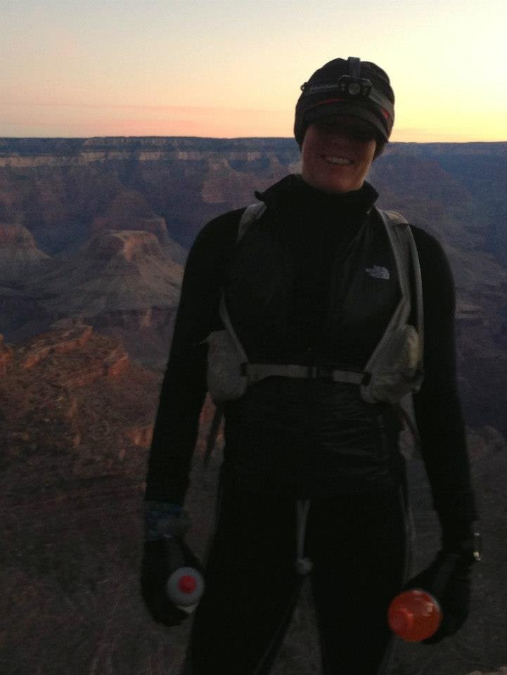
March 2013, before my first-ever R2R2R. So many things I had to learn… (and still do)
I myself have a long history of being infatuated with the Grand Canyon, and I remember well when I ran my first R^3 ten years ago: it was momentous. I set out on the Rim-to-Rim-to-Rim in early March, when the North Rim was buried under several feet of snow and there was no car access to the North Kaibab trailhead. This was my first non-race ultra run. It was my first big “backcountry” mission, the first time I set out on unknown trails, and the first time I dared to attempt by foot something that was beyond the reach of any vehicle.
I remember running into Gerd, the aforementioned 100x (or more) finisher of the Rim-to-Rim-to-Rim, with whom I bonded over our shared German heritage and love for the canyon. Gerd was already on his return journey to the South Rim when I was still climbing up towards the snowbound elevations of the North Rim; he insisted that I borrow his microspikes to navigate some treacherous iced up sections.
Well - that was in 2013 when I had barely started to develop my identity as an endurance athlete. Now, in 2023, I am a professional adventure athlete and co-own a premier hiking and backpacking guide service in Kanab, some 65 miles north of the boundary of Grand Canyon National Park. I have hiked, run, scrambled and rafted and guided 100s of miles in the Grand Canyon, and while I still think that the corridor trails are a magical playground for Grand Canyon first-timers I am now much more interested in the utter solitude and remoteness that the canyon has to offer once you venture beyond the crowds of the corridor.
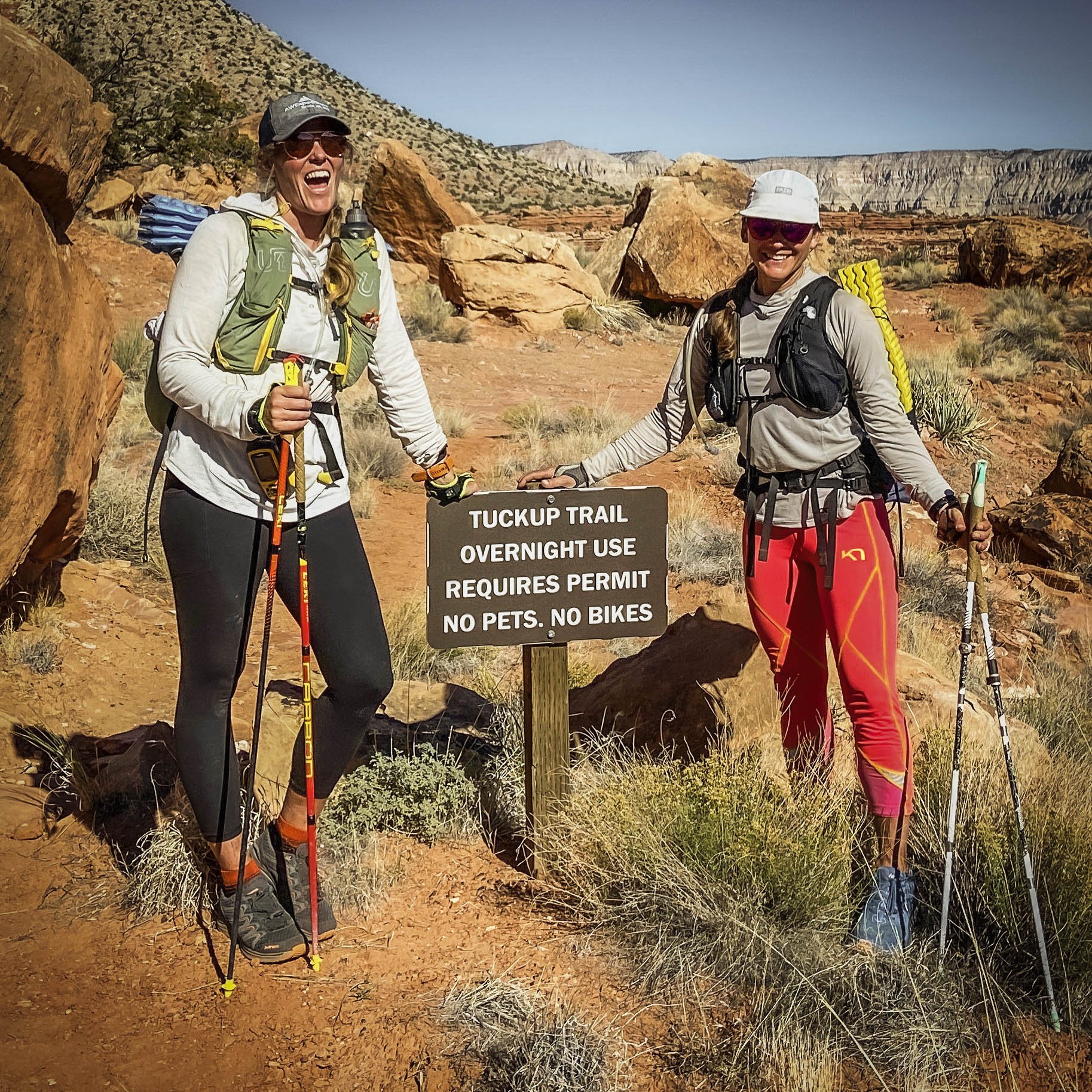
After 80 “fast” miles on the Tuckup with Ashly Winchester
That’s why, in late 2021, I completed a single-push effort on the Tuckup Trail with my friend Ashly (read more here or watch the short movie).
It’s also why, in late 2020, I set out on the Rim-to-Rim-to-Rim’s obscure cousin with my friends Christin Randall and Lexi Miller: together, the three of us became the first women to post an official time on the so called R2R2R-alt, which is a wild and remote double-crossing of the Grand Canyon along the North and South Bass trails the trailheads of which are many dirt-road miles west of the popular and easily-accessible corridor trails. The kicker for the R2R2R-alt though is this: there is no bridge across the Colorado River, which means that you have to boat or swim the river twice in order to complete this double crossing.
Swimming the Colorado River at the bottom of the Grand Canyon is a big deal for a few reasons.
You can’t just get in and out of the river anywhere - most of this section of the Colorado is guarded by steep cliffs, so you have to get it right (which is complicated by a strong current)
The water is extremely cold and bound to trigger a cold shock response
You are swimming the Colorado in between two major rapids
Those are the reasons why I initially had second thoughts about going for the Rim-to-Rim-to-Rim alt, and why I was glad for the company of Christin and Lexi (and her pack raft) for our initial attempt. Yet after Christin, Lexi and I safely completed our R^3-alt in a little over 22 hours in 2020, I knew that I was going to return at some point without company and without the psychological security of Lexi’s pack raft. It’s what brought me back to Swamp Point, the jumping off point for the Bass trails on the North Rim, in late October 2023.

Christin, Lexi and I during our team FKT on the Rim-to-Rim-to-Rim alt. Christin and I swam, Lexi pack rafted (and helped majorly with shuttling our gear and serving as spotter).
When I returned for the R^3-alt by myself I had a few elements going against me. I was utterly untrained; I had an extremely short window to squeeze in a good adventure between work obligations; and the temperatures were forecasted to plummet. Superficially, cold weather may seem like a good thing for this particular canyon route knowing that heat is a major and very dangerous obstacle in the inner canyon - but in this case, there was a NOAA freeze warning issued even for the low elevations of the Colorado River; and the idea of swimming brutally cold water in below-freezing air temperatures certainly gave me pause.
On the upside I had some elements going in my favor: I was (somewhat) familiar with the route; I had done the swim before. And, thanks to regular cold immersion at home, I was a lot more prepared for cold water than I had been during our first attempt. I also came in with a different strategy: where before we were hell-bent on having daylight for our swims across the Colorado, I was now a lot more comfortable with the idea of being in the water in the dark. That simple mindset shift allowed me to start down North Bass trail much later in the morning (6:00am in 2023 vs 2:15am in 2020), which saved a lot of nighttime navigation trouble in rough terrain.
With my new strategy, despite moving very slowly and taking alllll the time to smell the roses and take lots of pictures, I was able to lower then women’s speed record on the R^3-alt by over two hours.
The first time Christin, Lexi and I completed the R2R2R-alt, I told Runner’s World that I wouldn’t be shocked if someone were to die on it. That statement still holds true, but as the R2R2R-alt gains traction in the endurance world I want to share what I know to help demystify the river crossing for those adventurers who are capable of attempting this route - in the hopes of helping to introduce an element of understanding into what is a high-consequence endeavor. As such, here are my detailed recommendations about how to approach the river crossing.
The River Crossing: Step-By-Step Instructions
To swim across the Colorado River safely, you need to be cognizent of three different factors: temperature, river access, and gear.
1) Water Temperature
The water of the Colorado River at the bottom of the Grand Canyon is extremely cold. Why? Because the river is fed by dam release from Glen Canyon Dam at the downstream end of Lake Powell, meaning whatever water “enters” the river comes straight from the dark, cold depths of Lake Powell above Glen Canyon damn. Usually, the water temperature of the dam discharge ranges between 45 and 60 degrees. The lower the water level in the lake, the easier it is for the sun to warm the water - which is why, in October 2023 (when I completed my Rim-to-Rim-to-Rim alt), the dam discharge temperature was hovering around 60 degrees - a good 5-10 degrees warmer than during our previous run in 2020. The significance of this temperature variability cannot be underestimated.
With water in the 50 or 60 degree range, the cold isn’t merely a question of discomfort; instead, it will trigger the body’s involuntary cold shock response which, if not anticipated and managed properly, can cause drowning. I myself experienced cold shock during my first swim in 2020, despite wearing a full 3mm wetsuit. I wasn’t ready for it, and it was incredibly scary.
In my mind the water temperature is the single biggest risk factor for the river crossing. How do you address this risk? One, time your adventure such that you are not swimming at the coldest time of the year. Two, train for cold water: I found a practice of cold showers to be helpful; Wim Hof breathing surely would be beneficial as well. Three, anticipate cold shock and know how to work through it.
To monitor water temperatures at Glen Canyon dam, use this USGS link. Note that the data shows water temperatures at the dam varying seasonally by as much as 25 degrees (with a low of 45 degrees and a high temperature of 70 degrees). Timing your adventure to avoid the months with the coldest water temperature, i.e. springtime, is wise.
A word on flow: my primary concern before my first lap on the R^3-alt was the river’s flow rate. I assumed that it would be beneficial to time your river crossing with the lowest possible flow, translating to the least amount of current. I have since come to believe that, barring a major flood event, temperatures are a lot more important than flow rates. Regardless - check the USGS gauges to understand flow rates prior to embarking on this adventure, and, once you reach the river, trust your senses: don’t commit to the swim if the river is higher and faster than your confidence level!
2) River access - GPs coordinates
Prime swim route for a north-south-north R^3-alt. If starting the R^3-alt from the South you may have trouble locating the Bass Cable access from above.
Within the context of the Rim-to-Rim-to-Rim alt, the Colorado River is guarded by steep cliffs on both its north and south shores. Getting in and out of the river is one challenge; getting from river level to the trail is another challenge. The major beaches that are visible on satellite imagery are located right below Bass Rapid and right above Shinumo Rapid, which may be convenient for boaters but less than ideal for swimmers.
Having completed this swim twice now, I believe that these access points on the north side of the river are prime:
North side launch gully: 36.23434, -112.33992
North side exit beach: 36.23702, -112.34230
On the south side, I use the gully of the Bass cables located at 36.23500, -112.34162 as both entry and exit. This south side access point is a little tougher to get to than its counterparts of the North side, and it may be difficult to locate if you are doing this route starting from South Bass trailhead. If you are swimming across from the North, the old Bass cable infrastructure is an obvious visual marker at river level for where to aim for.
South Bass river access scramble. There may be another south side access location that is easier to get to without forcing you into white water or major detours from the trail, but I haven’t found it.
Spot the old Bass Cables on the right-hand side of the shot? This is what I am for when swimming from the North side.
Gear
After two slow but successful R^3-alts I feel like I finally know what kit is appropriate for this adventure. Here’s what I would recommend in addition to your standard 42-mile remote ultra trail setup - which of course needs to be conditions-appropriate and, in my opinion, should include a lightweight emergency bivy, some form of water purification, and GPS communication.
Kick fins that you can wear over your trail shoes - this will make a huge difference in the amount of energy you have to expend to get through the current. Being able to keep your shoes on with the fins saves time and makes the entry/exit that much easier. Look for fins made for float tube fishing (Amazon, ~$50).
A lightweight, large (35l+) dry bag big enough for all your gear except for the fins and your trail shoes. I used a 20l New Wave swim buoy in the past, but found it too small to fit everything I would have liked in there. Ideally, you should be able to get to the river, pull on the kick fins, drop your running pack, poles, and any excess clothing into the dry bag, and get going.
Some form of leash to attach the dry bag to your body. Just imagine what were to happen if the dry bag were to get away from you in the river. Pro tip: the dry bag pulls double duty as a powerful flotation device, but that only works if a) it truly is 100% waterproof and b) it is secured to your person.
Other considerations:
Poles are a must on this type of adventure. I love my collapsible and lightweight LEKI Ultra Trail poles. That said, a word of caution: don’t expose your collapsible poles directly to the Colorado. The sediment carried by the river, even when it’s running clear, is enough to clog the joints of a collapsible pole - I had to learn the hard way. Make sure to pack your poles inside your dry bag!
Wetsuit yes or no? Having done the swim with and without a suit, and knowing what I know now about cold shock, I don’t think that a wetsuit is necessary. In my opinion, preparing for your body’s cold response, and knowing how to work through it, is more powerful than adding a layer of neoprene - particularly if you bring a pair of fins coupled with a swim buoy or dry bag for flotation which radically reduces the physical effort you have to expend to make it across the river. The swim itself is very short - probaby no more than 2 minutes. If the air temperature is hot, swim in your clothing; it’ll help cool you down on the far side. If the air temperature is cold, strip naked and waterproof your clothing so you have something warm and dry to change into after the swim.
Water capacity. This one is hugely conditions dependent. In late October 2020 we carried 3 liters of water each, and struggled with dehydration and borderline heat exhaustion on the 15 mile dry roundtrip from the river to South Bass trailhead and back. We also didn’t find any reliable water sources on North Bass once we had exited Shinumo Creek. On Halloween 2023 I equally carried 3 liters but found that I didn’t even need that much - between cold temperatures and producing springs high up on North Bass, I easily could have gotten away with less. This is where your personal judgment and experience is crucial. Just don’t get it wrong, and remember that heat is one of the leading causes of death for Grand Canyon adventurers.
These are the pieces of advice that I would have enjoyed having access to before embarking on the R2R2R-alt for the first time. Of course there is a lot more to the route: trailhead access, route finding, start times, etc etc. Those more “run-of-the-mill” elements, though, are what I consider to be the meat of any big backcountry adventure, and they are what make off-the-beaten path ultra missions so engaging and appealing. In other words: get creative, and have fun working out your own strategy. Make good decision, be safe, and have a blast. If there are specific questions that you’d like advice on, don’t hesitate to drop a comment or reach out to me directly - I’m happy to help.
